
Garnock Valley, Renfrewshire
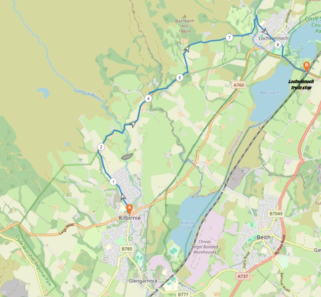
6 miles / 10 km
The hill roads between Kilbirnie and Lochwinnoch are what I would label as a hidden gem. This walk is my favourite walks in the Garnock Valley. It has mostly everything, including great scenery and views.
Lochwinnoch is a gem of a village and a nice end of the walk.

Pretty Hard
This walk has one long climb and several short steep descents and climbs. This walk is a good test of stamina, mind and strength. Good shoes and plenty of drinks are a requirement.

Train from Glasgow/Paisley/Johnstone to Glengarnock train stop 2 - 3 times an hour.
McGill's Bus 904 from Glengarnock train stop to Kilbirnie 1 time an hour.
McGill's Bus 904 from Paisley/Johnstone/Largs to Kilbirnie 1 time an hour.
Due to the 1 time an hour bus services between Glengarnock train stop and Kilbirnie, it is worth considering starting this walk with the flat, pretty interesting 2 miles / 3 km long road (pavement) from Glengarnock train stop to Kilbirnie.
The walk starts at the bus stop just across from the roundabout and the Radio City School building (ask the bus driver to be let of here). Kilbirnie is a nice, charming village, btw. Take the road to the left to the next roundabout. At this smaller roundabout 50 yards/meters up the road, cross the street and head up the Townhead to the right at this roundabout. Follow this road on the good pavement next to a small stream/burn and a housing estate. This road has now changed name to Milton Road. This road steadily climbs up the hill past some farm fields on a small single-track road to a farm.
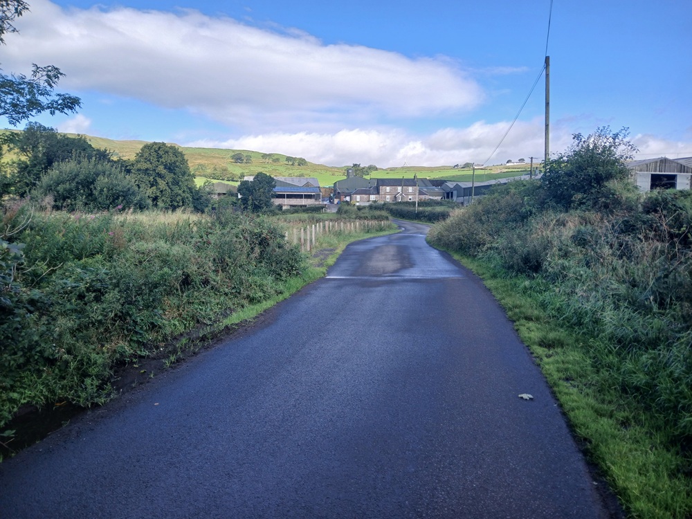
Take the road, the only road at this 90 degree right turn (and say hello to the local cat, farm animals and the farmer). The road follows a terrace above the valley floor before it descents to a small burn which is crossed by a bridge. The climb up from this bridge is steep and pretty challenging. Another road comes up from Kilbirnie here at a crossroad.
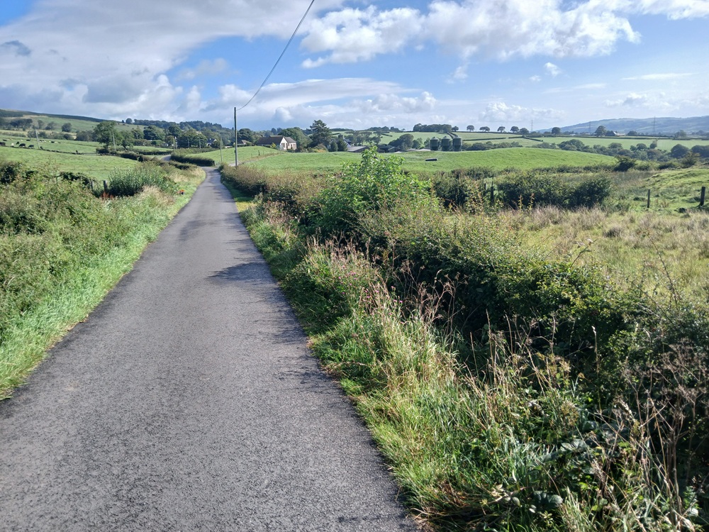
Take the road to the left here, straight on in fact. The road, with hardly any car traffic at all, is undulating here up to a field of pods... The Pods At Auchenhean, they are called. The road now goes through a dense forest. At the end of this forest, with a farm field to the left 3/4 of a mile / 1 km after the pods, take the road up to the left. Its name is Corsefield Road and it takes the walk up a small incline to a viewpoint over the valley and then... Lochwinnoch.
The road now drops down to Lochwinnoch Golf Course and the clubhouse there. Take the road to the left again and 150 yards/meters further up the road, take the road to the right again to a bridge, crossing this burn/stream. A 50 yards/meters detour up the road to the left for a look at Calder Mill Waterfall is well worth the effort. Take the road again to the right after the bridge past a housing estate down to Lochwinnoch.
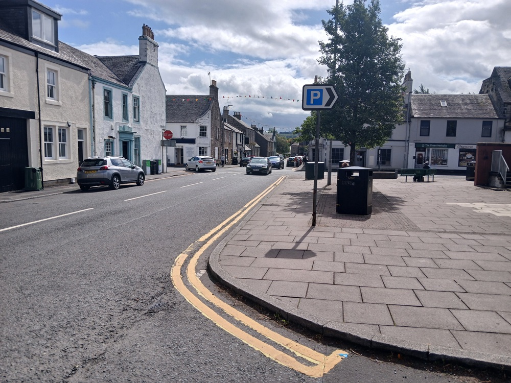
You can either check out the shops here or continue straight through the crossroads on Church Street past the pretty Calder United Free Church and then take the road to the right at the end of this street. After 50 yards/meters, go through the gate to the cycle/walk path and take this path to the right, which takes you over a small pedestrian bridge and then to a set of traffic lights. Cross the road here and then follow the signposts to Lochwinnoch train stop.
Train to Johnstone/Paisley/Glasgow 2-3 times an hour.
Enjoy the walk !!