
Largs, North Ayrshire.
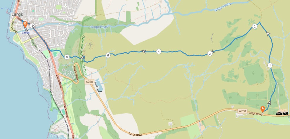
4 miles / 7 km
A hard, very scenic walk over the hill from Clyde Coast And Garnock Valley Crematorium. The path is boggy in parts. I lost and then recovered a shoe in a waterhole. A true bad experience which has put me off this walk this year... and probably next year too. Besides the crossing of this 50 yards/meters wide bog, the rest of the walk is pretty brutal too, with the staircase down a big wall not for the fainthearted and others with mobility problems.

Hard
The walk is short. But most of it is hard to very hard. The bus or train/taxi, at least 1.5 hours, to the start at Clyde Coast And Garnock Valley Crematorium, is both long and tedious. The bog part, which can and must be avoided by a detour to the left after leaving the top, is hard too.
The walk can only be done after a long period of sunny, dry weather. Preferably on a sunny, clear day, as the scenery is fantastic on a clear day. Walking poles, mountain shoes, sun cream and plenty of drinks are required.
This is not a suitable walk for those who are suffering from vertigo.

public transport
McGill's Bus 904 from Paisley/Johnstone/Glengarnock to the Clyde Coast And Garnock Valley Crematorium 1 time an hour.
Train from Glasgow/Paisley/Johnstone to Largs 1 time an hour. Then a taxi from Largs Railway station to Clyde Coast And Garnock Valley Crematorium £ 10 - £ 15 /
McGill's Bus 904 from Largs to the crematorium 1 time an hour.
The walk starts from the bus stop at Clyde Coast And Garnock Valley Crematorium. Take the road to the right and cross it onto the pavement on the other side. At the end of the pavement, follow the verge on this road for 300 yards/meters to a small parking space with a CCTV sign on it. Take this gravel road to the left up the hill. The gravel road merges with the far better gravel road coming up from Mills Milk after 300 yards/meters. The road is now climbing this glen.
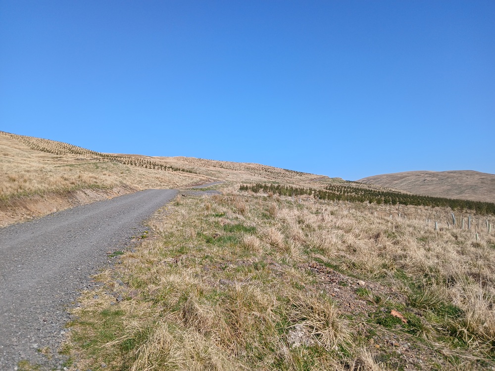
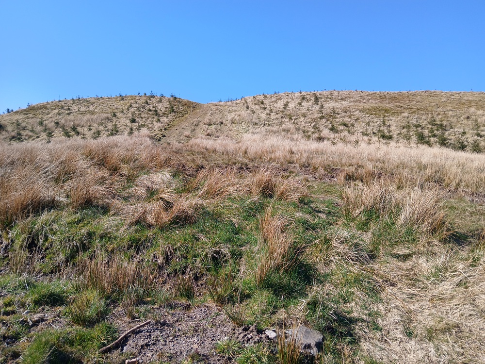
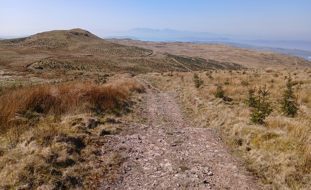
The climb ends up in some sort of mountain pass. To the left, there is a path on a grassy bank leading up to the left (see picture). Climb this path to the top of this hill at 1275 feet / 388 meters above sea level. The remaining part of the walk will lose 1200 feet / 375 meters in height difference.
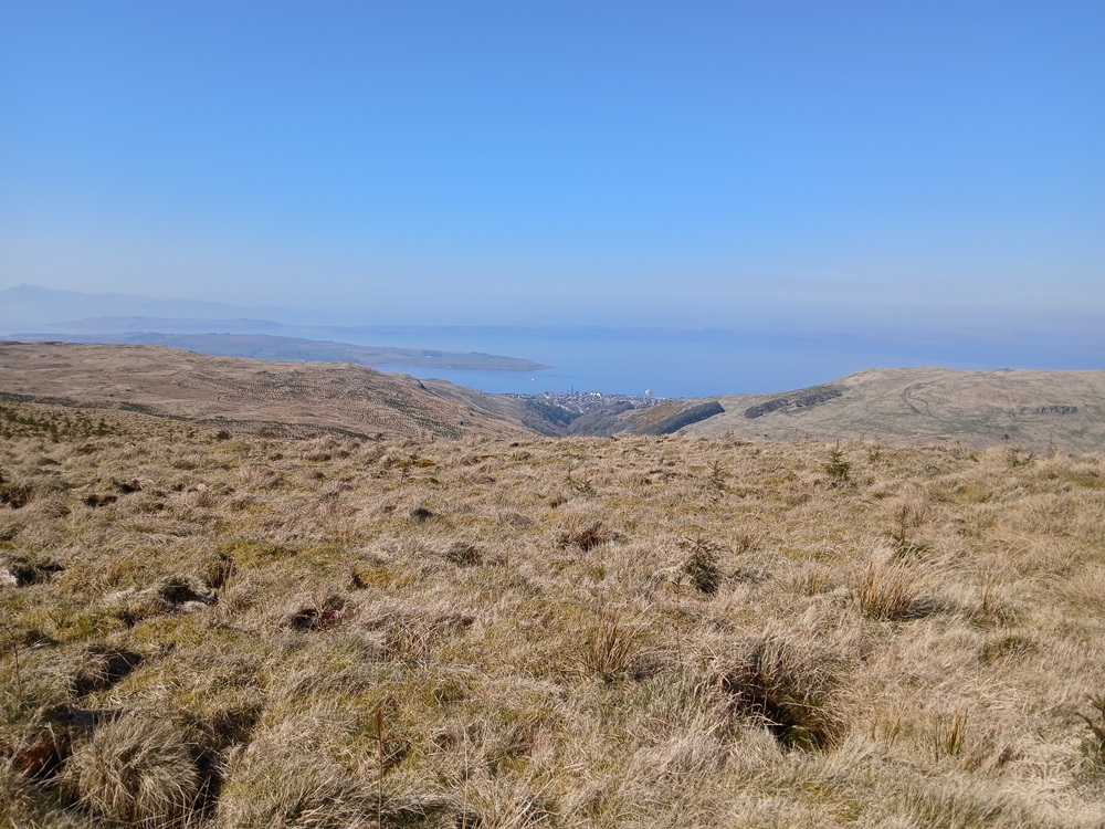
From this nameless top with these excellent views, try to find the path to the left. I did the mistake of going straight down the hill, direction Largs in the distance. Bad, bad mistake and I ended up in this bottomless wet bog with the loss of a shoe, which I thankfully found again after some digging with my two hands in the bog. Not a good memory.... So stick to the left where a grassy path is now taking the walk down this ridge towards Largs. There are several small humps and small wet depressions along the ridge down towards Paisley. I will let the four following pictures tell this story.
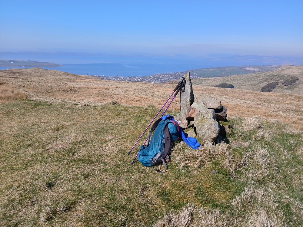
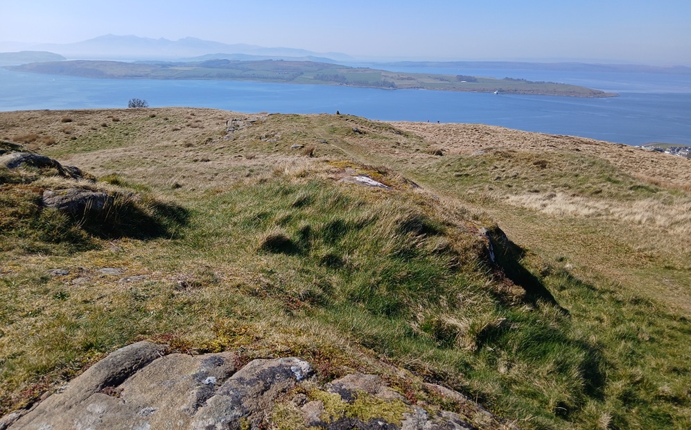
The path ends up at the hill above Haylie Reservoir and the aptly named Largs Viewpoint. Take the path, and be very careful here, to the right to the top of the staircase down this wall to the valley, make that the grassbanks above Largs. The approach to the staircase and the staircase is not for the fainthearted and those suffering from vertigo. The same can be said about the not-too-bad staircase itself. The picture below is taken below the staircase.
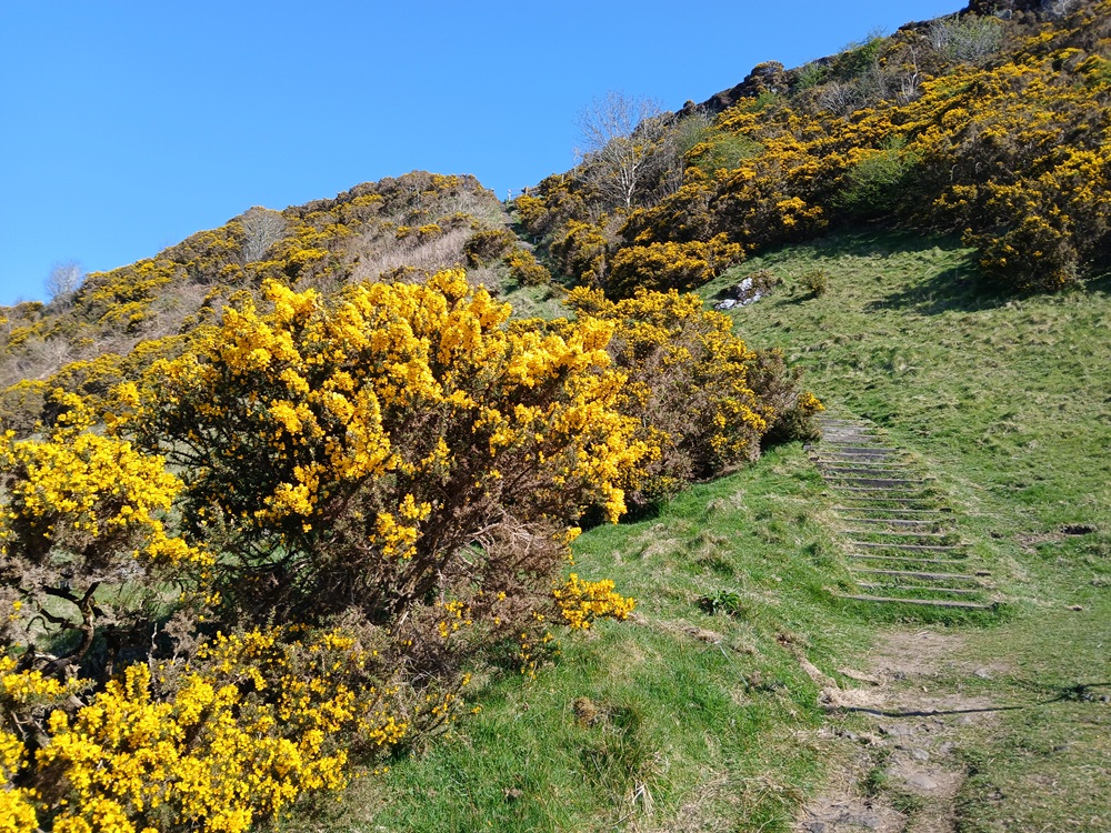
The worst of the vertigo/accident inducing path is now over. There are still some more staircases, six gentle staircases, to negotiate before the path ends at Douglas Park Bowling Club. Look back up the hill and be proud of yourself.
Take the road to the right down to Largs Railway Station where this walk ends.
The McGill's Bus 901 from Largs to Wemyss Bay/Gourock/Greenock/Braehead/Glasgow 4 times an hour (highly recommended).
The McGill's Bus 901 from Largs to Wemyss Bay/Greenock/Braehead/Glasgow 4 times an hour (not recommended).
The train from Largs to /Glasgow 1 time an hour (not recommended).
(For travellers to Paisley, I recommend McGill's Bus 901 to Port Glasgow and then the Port Glasgow - Paisley train 4 times an hour.)
Enjoy the walk !!